Aerial Delivery Without GPS
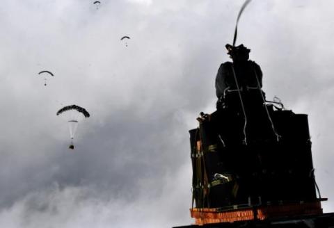
CAMBRIDGE, MA – Dropping critical supplies from the air has allowed the U.S. military to rely less on easily-ambushed truck convoys and helicopter resupply. Exposure to improvised explosive devices (IEDs) and ambushed convoys resulted in more than 3,000 causalities in Afghanistan and Iraq through 2007. The U.S. Army’s Joint Precision Airdrop System (JPADS) has proven to be an important tool in the Army’s logistics chain in many scenarios to supply troops with material and equipment in adverse terrain and remote locations when ground lines of communication are not possible or deemed too high a risk. Because of the success of using airdrop, to include JPADS, the Army life cycle manager, Product Manager Force Sustainment Systems (PM-FSS) continues to improve the JPADS capability with technology enhancements being led by the Army’s Natick Soldier Research, Development and Engineering Center (NSRDEC), including making JPADS more robust and versatile to environment, terrain and other factors. Investments are focused on significant increased accuracy, lower cost and lower retrograde weight/volume of the reusable JPADS at all weight classes.
The U.S. Army NSRDEC, with Draper and numerous other partners, recently began testing a new version of the JPADS guidance system that takes advantage of Draper’s technology to navigate precisely to its intended ground impact point using imagery alone, and having minimal knowledge about the aircraft’s location when the package is dropped. The accuracy is critical, as payloads that stray even slightly off course can force troops to expose themselves to enemy fire, or can tumble down mountainsides in rugged terrain, explained Chris Bessette, Draper’s JPADS program manager.
“This is a huge step forward for aerial resupply,” Bessette said. “The guided airdrop system is keeping U.S. forces from the danger that has killed thousands of their fellow troops. By enabling the system to operate using imagery alone when dropped as high as 25,000 feet above Mean Sea Level and upwards of 20 miles away from the target depending on winds, we can ensure that JPADS is even more versatile so troops receive supplies like fuel, ammunition, food, and water in the safest manner possible.”
Draper’s JPADS software autonomously flies the cargo-carrying parafoil to land at a user defined location, adapting in real-time to local environmental conditions, such as varying wind. The company’s work on JPADS takes advantage of its expertise in applying position, navigation, and timing algorithms to combine the outputs of precision instruments to enable highly accurate, long-duration navigation solutions.
The recent testing demonstrated the ability to accurately navigate JPADS to a pre-selected user position, using imagery alone, with almost no information about where the package was released from the plane. During testing in Arizona, the payloads were dropped from planes, and then JPADS immediately determined their own location by comparing terrain features spotted using optical sensors with commercial satellite imagery of the area.
The Army is also supporting Draper in developing upgrades to the vision-aided navigation system to address current limitations, including cloud cover, which degrades the system’s ability to correlate vision sensor inputs with satellite imagery.
The military can leverage the same technology to help guide military free fall paratroopers and unmanned aerial vehicles utilizing imagery data alone, Bessette said.
Released January 12, 2016

