Mobile App Lets Parachutists Land with Precision
CAMBRIDGE, MA—Parachutists gliding to a designated landing zone can go off course and lose their way. In such a situation, a routine jump quickly can turn dangerous. For a military parachutist unable to keep on course—or change course to a new landing zone—descending to Earth can potentially put their life in jeopardy and those around them in danger.
“Without a fail-proof way to communicate with each other, military parachutists are at risk of going off-course and landing far away from each other, which could be a real threat to their mission,” said Skye Savage, human systems engineer at Draper.
Savage has studied parachutists and their jump teams for the military. She and her colleagues recently filed a patent for a system that automatically detects when parachutists make the critical transition from the plane to being under their parachute canopy. “Our goal is to boost the jump team’s chances of landing on target, even if they need to change their landing point during the mission.”
Draper’s division leader of Information and Cognition, Emily Vincent, said the system is designed to help jump teams succeed in the dynamic and changeable environment of a jump. “Our goal is to seamlessly integrate the technology into the jump team’s workflow in a way that enhances their situational awareness of the environment and the other members of the team.”
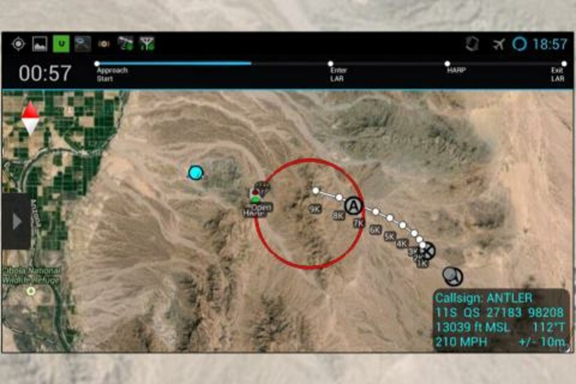
To design a successful parachute navigation system, Draper engineers had to overcome a host of challenges. The navigation system had to be easy to use throughout the jump. It needed to be on a touch screen, outfitted with interactive features, accessible by parachutists wearing gloves and equipped with a data layer showing terrain maps, GPS inputs and new landing points sent from the jump master. It also needed to able to guide a parachutist to a landing spot from as high as 20,000 feet and from miles away.
“Giving parachutists a sense of direction and orientation during a jump is a challenge because they are moving so fast and potentially pushed around by heavy winds, or need to adjust to changing conditions,” said Savage. “Our technology improves mission success during jumps by keeping the team safer and in communication with each other.”
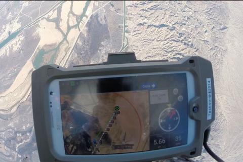
The system operates as a plug-in to a smartphone—the first version is for the Android platform. Parachutists can use the app to see the terrain below them, the location of the jump team around them and the designated landing point. The app can also track the parachutists by sensing the moment they leave the plane. The app automatically switches navigation modes at that point, leaving the parachutist free to focus on maneuvering their parachute rather than adjusting the app.
“Draper’s human-centered design focuses on the human at the center of the mission, in this case, the parachutist,” Vincent said. “We help teams with dynamic situational awareness needs, giving them better understanding of their environment and innovative decision support and communication tools. Our systems can be configured for a variety of users, such as warfighters, firefighters, astronauts, emergency room nurses and disaster recovery teams.”
The current advance in navigation systems, which was funded by the U.S. Army, is part of Draper’s growing human-centered solutions portfolio. The portfolio includes a “take me home” button designed to return astronauts safely to an orbiting space station. Draper has deep skills in the design, development and deployment of systems to support cognition in a range of situations—for users seated at desks, on the move with mobile devices or maneuvering in the cockpit of vehicles.
Released February 15, 2018


