Draper’s DMEN Aces Flight Tests
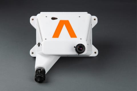
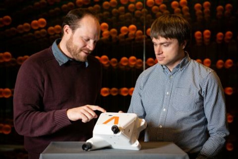
CAMBRIDGE, MA—Draper is developing a way to help spacecraft land on the moon with greater precision, using navigation system technology that rivals LiDAR, radar and other camera-based solutions. The Draper Multi-Environment Navigator, or DMEN, system uses vision-based terrain relative navigation technology to track features in the lunar surface and deliver precision localization information during a spacecraft’s descent.
Recently, DMEN traveled as a payload on the Blue Origin New Shepard’s 23rd mission. It was one of 36 payloads from academia, research institutions and students across the globe.
The flight on New Shepard was the latest in a series of tests for DMEN. To improve the system’s accuracy, Draper developed software that fuses data from vision-based and inertial navigation systems and that benefits from the advantages of both sensing approaches. The purpose of the flight test was to gather real-world data that will enable Draper to improve a lander’s ability to safely reach the lunar surface.
“Draper is advancing DMEN by taking it higher and faster, and testing its capabilities at rocket speeds,” said Brett Streetman, distinguished member of the technical staff at Draper. “The latest DMEN flight test ensures Draper is continuing to advance its technology, aiming for greater robustness and maturity as it prepares for future lunar landing missions.”
Results of the flight tests were presented at the January 2023 AIAA SciTech Forum in National Harbor, Md. The conference paper describes DMEN’s performance during flights on Blue Origin New Shepard and a high-altitude balloon flight by World View Enterprises.
Dominic Maggio, lead author of the paper, said the research team tested DMEN’s performance across a range of conditions. DMEN flew at altitudes ranging from 4.5 km to 33 km and at speeds of up to 880 km per hour (550 mph). DMEN scanned the terrain below, pinpointing landmarks that appeared most promising for landing, using satellite imagery, camera images, United States
Geological Survey elevation maps and software developed by Draper called Image-Based Absolute Localization, or IBAL.
“IBAL is designed to run in real-time on flight hardware,” said Maggio, a master’s of science degree candidate at MIT and a Draper Scholar. “Our motivation for this paper was to demonstrate a rigorous analysis of terrain relative navigation in all three phases: ascent, descent and landing. It’s a challenge to gather data sets at high altitudes and high speeds, but we did it.”
In the paper’s conclusion, the researchers said Draper’s DMEN achieved an accuracy that helps advance the technology for use in terrain relative navigation. The balloon data over a trajectory of 150 kilometers was accurate within 290 meters, and the rocket data was accurate within 55 meters.
Preparing DMEN for this research was funded in part under NASA’s Flight Opportunities Program. According to NASA, DMEN has achieved a technology readiness level, or TRL, of 6-7 for both ground and low-altitude operations. Test flights, like the one on New Shepard, allowed for the collection of data and validation of algorithms in a suborbital environment, which helps Draper advance the development of DMEN in its TRL.
Since 1973, the Draper Scholar Program, formerly known as the Draper Fellow Program, has supported more than 1,000 graduate students pursuing advanced degrees in engineering and the sciences. Draper Scholars are from both civilian and military backgrounds and Draper Scholar alumni excel worldwide in the technical, corporate, government, academic and entrepreneurship sectors.
Released March 21, 2023


