Spotting Trends in Satellite Imagery
CAMBRIDGE, MA – Policy makers need to understand local cultures as they address problems around the world ranging from civil unrest to disease outbreak. Understanding these cultures can help decision-makers better understand how the communities may react to relief personnel delivering vaccines, recommendations for quarantine, and other possibilities. Sending personnel overseas to conduct surveys can be costly and time consuming. In some cases, U.S. personnel may not be welcome.
Draper is helping address the challenge of studying foreign cultures without sending people outside U.S. borders by developing a set of computer models to analyze commercial satellite imagery for factors that can indicate attitudes towards governance, economic well-being, and community engagement. The company is studying the effectiveness of its image-based Socio-Cultural Observation, Prediction, and Estimation (iSCOPE) models using satellite imagery of sub-Saharan Africa, and comparing the results with available survey data.
The National Geospatial-Intelligence Agency is funding the work, which is expected to wrap up in April. The project is intended to build on earlier success and demonstrate broader effectiveness of Draper’s models, which predicted economic, political, and cultural characteristics with an 85 percent success rate using satellite imagery of Afghanistan with funding provided by the Office of Naval Research.
The models could serve as a worldwide resource for cultural studies as well as informing policy makers, helping improve disaster relief efforts and making military engagements safer, said John Irvine, Draper’s chief data scientist.
“Better data analysis leads to better decision-making,” Irvine said. “In many cases, we already have sensors providing the data we need to solve problems – we just need a way to analyze the data.”
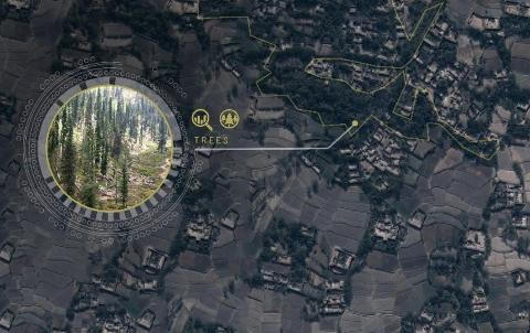
Key physical features in satellite imagery that can drive predictions about socio-economic issues include a high concentration of trees in an area of interest, which is a key indicator of wealth, Irvine said. This can help analysts understand the economic distribution within a region, information valuable for developing effective policies to promote social, health, and development opportunities, he said.
In some cases, the iSCOPE models may help identify an alternative to sending personnel across the globe into potentially dangerous areas to gather data. In others, the models may help develop a more narrowly targeted plan for deploying staff.
The iSCOPE effort is part of an integrated portfolio of resources at Draper intended to help government and industry analysts make better use of big data sets. The models can provide better cultural context to other tools, such as those that Draper is developing to predict panic during disease outbreaks. Draper also can apply the iSCOPE models to its efforts to help companies develop more-relevant products from new commercial satellite imagery constellations. The company is also working with the Defense Advanced Research Projects Agency (DARPA) on the XDATA program, helping DARPA measure the effectiveness of analysis tools and how to improve them.
Released December 10, 2015

